Episode 186
Packrafting and Tramping 48 Days Through Fiordland with Penzy Dinsdale
Episode 186
Packrafting and Tramping 48 Days Through Fiordland with Penzy Dinsdale
Spotify Apple Podcasts Everywhere else Download
I've always said I'm too scared of Fiordland to do any major expeditions there. Then Penzy came back on the show, and now that south coast is looking a little bit tempting (and Isaac is going to be frothing).
Some of you will remember Penzy from her 85-day traverse of the Southern Alps. She's a doctor who's built her career around adventure, with work in expedition medicine, Antarctic ships and Everest Base Camp, and she's training to be an alpine trekking guide. And she's back because she's gone and finished the sequel: 48 days through Fiordland. The two trips together make a full South Island traverse, a goal she's had since university.
So we follow her route the whole way, with my topo map open so I could keep up (mostly). From Falls Creek on the Milford Road, through packrafted lakes, flooded rivers, a brand new lake, Dusky Sound and the wild south coast to Westies Hut and Slope Point. Plus how she found two strangers to come with her, what she ate, what she lost, and how you take an expedition from idea to actually happening.
In this episode
- From orienteering to expedition medicine
- Fitting big expeditions around a medical career
- Finding a team for Fiordland
- Falls Creek to George Sound Hut
- Packrafting Lake Te Anau around the Murchison Mountains
- Delta Burn, Stevens Falls and the Freeman Burn
- Lake Manapōuri, the Dusky Track and Supper Cove
- Dusky Sound to Long Sound by packraft
- The south coast from Puysegur Point to Westies Hut
- Food, low points and making an expedition happen
From orienteering to expedition medicine
Penzy grew up in Wellington, where her family's adventures were orienteering: most Sundays, most holidays, and the orienteering nationals every Easter. As a teenager, her parents got strategic and suggested she go tramping to a hut with a bunch of friends. From there came the Duke of Edinburgh Awards, then the Otago University Tramping Club, where she tramped as much as possible and studied only enough to get by.
Once she started working, it got a lot harder to find people with the time to get out every weekend. So Penzy started building her career around adventure: expedition medicine, time out for bigger trips, and alpine trekking guide training.
Fitting big expeditions around a medical career
Penzy calls herself a serial job quitter. The first time she quit, someone told her there's no such thing as an unemployed doctor, and it's quite true. The health system needs doctors, and there's always locum work.
Her career advances more slowly, and some colleagues from med school are bosses now. A lot of them tell her she's wasting her life. She doesn't want what they have: too many work hours and a lot of burnout.
I felt the same in my corporate job, looking at bosses years ahead of me in their careers and knowing I didn't want to be there.
Finding a team for Fiordland
On the Southern Alps traverse, Penzy went from the Milford Road to Farewell Spit. She had a job to go back to and needed to reach Mount Cook while the snowfields were intact, so Fiordland would have meant paddling up the lakes. That didn't seem like the way to do Fiordland, so she saved it.
It kept getting pushed back. Much of the route was packrafting, which she didn't want to do solo, and Fiordland is much harder to get in and out of. Then she was offered work as a doctor at Everest Base Camp with Adventure Consultants, so the trip moved to the 2025/26 summer, fitted around her Snow and Ice Guides course, an Antarctic season, kākāpō recovery volunteering on Whenua Hou and a new job. A bit of Tetris.
After Everest, she gave an online talk on getting started in expedition medicine for the Australasian Wilderness and Expedition Medicine Society, and ended by inviting anyone to join her. Two Australian-based doctors (one originally from New Zealand) reached out. They were planning a medical gap year with the classics, trekking in Nepal and skiing in Japan, and somehow decided Fiordland would be better. Their only Fiordland experience was the Milford Track.
Did Penzy tell them about the sandflies? She did not. They researched those themselves, with advice from one of New Zealand's top expedition medics. It turns out bush bashing in Australia is quite different. They started as internet randoms, and they're friends now.
Falls Creek to George Sound Hut
The route ran from the Milford Road down to Puysegur Point, around the south coast, then by bike to Slope Point, the southernmost point of the South Island.
Falls Creek to Glade House
Penzy started at Falls Creek, close to the Divide Shelter where her first traverse began, and somewhere she'd once turned back early because of tree falls. They went up Falls Creek, around past Consolation Peak, then over U Pass and Glade Pass to Glade House at the start of the Milford Track. That was a four-day warm-up. At Glade House they collected eight days of food and their packrafts, and that afternoon paddled round to Worsley Hut.
Worsley Pass to the Edith River
They went over Worsley Pass and through the top of the Wild Natives catchment, which looks improbable on the map, up past a couple of tarns to Taheke Saddle, at the top of Taheke Creek. The creek next door is Kakapo Creek. It was very boggy, and the one man on the trip admitted he'd expected nice, open, easy travel. As Penzy told him, there is no such thing in Fiordland.
Next came Taheke Creek, the Glaisnock, Midnight Creek and Edith Saddle, into the Edith River. On a side creek of the Edith, in a scratched-out campsite, Penzy spent her birthday.
Lake Alice and the George Sound Route
They carried their packrafts because the lakes ahead can't be crossed without them. They packrafted Lake Alice, bush bashed around Alice Falls, and paddled to George Sound Hut for their first rest days, well earned after going very hard. Then came the George Sound Route, boggy and at times hard to follow, broken up nicely by packrafting the lakes. At Lake Hankinson, above Lake Te Anau, you have to packraft again (walkers can arrange a boat with an operator).
Packrafting Lake Te Anau around the Murchison Mountains
South of Lake Te Anau are the Murchison Mountains, the Takahē Special Area, where you basically can't go. Plan A was an intense set of routes from Moir's Guide, up the Doon River and around the back of it. But the three of them weren't moving at the speed Penzy had planned for, and they'd have needed to walk every day. You just don't get weather to walk every day, and with several days of rain forecast, they'd have run out of food.
So Plan B was to packraft right around the Murchison Mountains, still a big undertaking on a huge lake: the Northwest Arm, the Middle Fiord, the main body of Lake Te Anau, then up the South Fiord. Penzy had been anxious about it. She'd nearly been tipped out by wind and waves there before, and packrafts sit high on the water and get blown around.
I hear her. We trained for our sea kayak expedition on lakes, and I've never felt as scared in a kayak as I did on Lake Wakatipu. You expect lakes to be calm, but the mountains funnel the wind straight through. A seasoned kayaker we met on the trip told us the ocean is so much safer than the lakes.
They waited a couple of days on an island for conditions, and their day on the open lake was beautiful. Friends met them there by jet ski with their next resupply. With packrafts and 12 days of food, they were surprised everything fitted in their packs.
Delta Burn, Stevens Falls and the Freeman Burn
From the South Fiord they went up the Delta Burn, a route once raced in GODZone. Penzy figured that made it challenging but fine. Props to the racers, because it was insane, with a few sufferfest spots in thick scrub. On the next lake, they watched wind spirals whip water off the surface for a whole day, and a strong squall still hit them partway across. Quite terrifying.
Going down the Stevens Burn means crossing giant moraine boulders covered in forest, with man-eating holes between them, on moss and rotten logs. They broke several things that day, none of them people. One was Penzy's faithful Macpac carbon fibre pole, a gift from a friend, which had done all 85 days of the first traverse. It couldn't survive Fiordland, which says something about Fiordland.
The descent past Stevens Falls is very, very steep. They used the packraft throw line to lower themselves down one bank, and somewhere along there Penzy lost her inReach Mini. She didn't notice until hours later, and going back wasn't realistic. They weren't tracking constantly, because they didn't carry the battery power, so she'd been sending their camp location once a day. She was destroyed:
"It was how we were getting our forecasts. It was how people were tracking where we were at. It represented like a huge loss of contact and a loss of control when I lost it."
If you're ever down there, please bring it back.
A flood and a brand new lake
They camped in the Freeman Burn and the river flooded, so they spent a day in their tents hoping it wouldn't reach them. Penzy was bailing puddles out of hers.
Next day they packrafted from camp, rounded a corner and found what looked like a big flat lake, with dead trees standing in water from bank to bank. It was an unmarked lake, formed by a slip. You'd struggle to get up or down the Freeman Burn on foot past it now, but you can packraft it: they paddled to the slip, boulder hopped across and got back on the river below. It was a first for Penzy, finding something that big that wasn't on the topo or anywhere online, and she wrote a warning in the hut book.
At Freeman Burn Hut, three men were fishing and hunting on a random Monday in March, and three kayakers arrived across the lake. Penzy slept inside with the three men, while everyone else camped outside. It was the group's first time meeting anyone in a hut, and it was a turning point for the other two, who realised how many amazing people you meet in huts.
Lake Manapōuri, the Dusky Track and Supper Cove
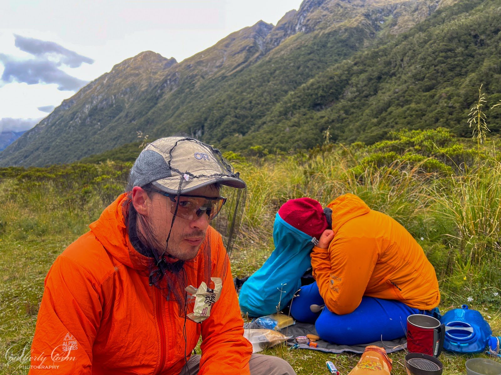
They packrafted down the North Arm and up the West Arm of Lake Manapōuri to the start of the Dusky Track. Three friends joined them at West Arm Hut with another food drop. The plan was a route over the tops, but the weather was the worst of the trip, so they walked the Dusky Track. After a big debate about how much food to carry, they erred on the side of lots, and still had enough spare to stock up a Czech bikepacker passing through.
After Upper Spey Hut, they crossed Centre Pass in winds of at least 100 kilometres an hour, knocked to the ground and crawling. Looking back, Penzy says what they were doing was definitely not super safe. On the pass she set a rule: if it didn't improve within about 20 metres down the far side, they'd go back. It did. Her pole broke there for the last time.
From Kintail Hut and Loch Maree Hut, the three friends headed back, and the original trio went on to Supper Cove, packrafting some of the Seaforth River with the water up a little and decisions to make around the rapids. They sat out a couple of days of bad weather at Supper Cove Hut.
Fiordland was far busier than she expected. One day it was like a mini airport, with helicopters landing on the beach, and Penzy kept wandering down to chat to people. It turns out a lot of people access Fiordland by boat, which is the way to do it, really. A big yacht anchored for the night and invited them aboard for hot showers, Wi-Fi and crayfish, one of the highlights of the trip.
It's funny how normal things become a treat on an expedition. After our slow paddle, my first night in a bed felt amazing.
Dusky Sound to Long Sound by packraft
Instead of the Heath Mountains or the Dark Cloud Range, they rerouted to packraft part of Dusky Sound, on a line some packrafters had done a couple of summers earlier. They'd only just got comfortable paddling lakes, and now they were heading onto the fiords. At George Sound Hut, they'd found an FMC bulletin with the write-up, and while she still had the inReach, Penzy messaged one of them for advice.
They paddled past Fanny Bay and down the Cook Channel to camp below Glen Alpine Pass, knowing heavy rain was coming. Penzy's tent site flooded and she woke floating on her sleeping mat. Then it was over the pass into the Lumaluma Creek, over a saddle and down a steep face to Oho Creek, using the handline a couple of times for comfort.
Oho Creek is amazing for packrafting, with a chain of lakes including Lake Carrick, then through to Lake Cadman. Be very careful not to get sucked over the falls at the end, which appear out of nowhere (there's a track around them). With a headwind at Lake Cove and no decent camping, they camped on a small island so they'd be on the sound for an early start.
They paddled down Edwardson Sound to their first view of the open ocean and a little swell, then up Te Korowhakaunu / Kanáris Sound, the most exposed corner of the route, to Cliff Cove, where a short, beautiful bush walk leads to Long Sound. Down Long Sound the rain and wind came and went all day, with constant decisions about whether to stop. The stretch from Revolver Bay to Kisbee Bay is more exposed to swell, so they rewarded themselves with a stop at Kisbee Lodge, a private hunting lodge with very lovely staff.
That night's hut, with their food drop, is a cute little A-frame, but it's in a swamp with a stream under it, with two beds and a muddy floor, so Penzy camped instead and doesn't recommend it. The next morning was perfect for paddling, and they made it to a landing within a kilometre of the open ocean.
Around here I got so excited I mixed up her trips and asked if they were up to day 70. Wrong expedition. This one was 48 days.
The south coast from Puysegur Point to Westies Hut
From there a marked track leads to Puysegur Point, the southernmost point of Fiordland, where they had lunch. They lost the Wilson River pack track within a couple of hundred metres the next morning. It's not well worn or well marked, so they bush bashed to the Wilson River and camped on a little space on the bank, a bit anxious about time and food, now on foot with their packrafts for nearly all of the rest of the trip.
They took the coastal route over the inland one, because it looked more interesting, even though people warned it would take a fortnight. It didn't take them that long.
Westies Hut
They packrafted down Lake Hakapoua late in the day and couldn't find the track to Westies Hut, which starts up on a little hillock. They set a time limit to camp. Then one of her companions walked a few metres into the bush and found a giant triangle, and they reached Westies just on dark. Such a good feeling.
Westies is a hut in a cave with a fire-heated shower. They spent two whole days there, then walked the South Coast Track for four days to Rarakau car park, 45 days in. Penzy biked the last three days to Slope Point.
Food, low points and making an expedition happen
Their food was nearly all dehy, a good amount homemade. Penzy takes what she'll want to eat, including chocolate and lollies, because enjoying it matters more than perfect nutrition. She didn't do her nutrition as well as on her last expedition, and really felt it in the second half. On long expeditions she also takes a multivitamin, after another expeditioner said it stopped them feeling flat. At its heaviest, her pack stood up to her belly button.
She had wet boots for 45 days. Losing the inReach was a low point, and so was the next day, when the weather blindsided them. But she never wanted to quit, even when she declared this was her last expedition:
"I might have recorded myself saying, "This is it, no more expeditions after this, I'm done." And then I vividly remember within about 30 seconds being like, "You know what, no, there will be more expeditions.""
Westies Hut was one of the highlights of the whole trip, because suddenly everything left was manageable. The group had dreaded the south coast for much of the trip, and it ended up fine, with good weather. Reaching Westies felt like they'd made it.
Her advice for making an expedition happen: plan the route, then set a time. Once you've said you're doing it, everything else follows, from people to food:
"once you set yourself a deadline in a way, then everything else starts to kind of just happen"
It took ages to sink in. She went straight to Whenua Hou and back to work, and has to remind herself she had 48 days of adventure this year. She filmed a lot of both traverses and hopes to do something with the footage. Her list just got longer, too: the big route behind the Murchison Mountains (when we recorded, you could go through on a permit at certain times of year, if you met the conditions) and the Dark Cloud Range. From September to December 2027 she'll volunteer with the Himalayan Rescue Association at Pheriche.
I know the feeling. We planned to paddle from Cape Reinga to Tauranga and see it all, but the weather rushed us along, and the swell stopped us paddling through the Hole in the Rock in the Bay of Islands. We'll have to go back.
Plenty of people walk Te Araroa the length of the South Island. Penzy carved her own route by foot, ski, packraft and bike, through places most people will never see.
Places from this episode
- Fiordland
- Milford Road
- Falls Creek
- Consolation Peak
- U Pass and Glade Pass
- Glade House
- Worsley Pass
- Taheke Saddle
- Edith Saddle
- Lake Alice
- George Sound Hut
- Lake Hankinson
- Lake Te Anau
- Murchison Mountains
- Delta Burn
- Stevens Falls
- Freeman Burn Hut
- Lake Manapōuri
- Dusky Track
- Centre Pass
- Supper Cove
- Dusky Sound
- Glen Alpine Pass
- Long Sound
- Puysegur Point
- Westies Hut
- South Coast Track
- Slope Point
Follow Penzy
- Instagram: @penzyd
Links from this episode
- Follow Penzy on Instagram: instagram.com/penzyd/
- Penzy's photography: southerlystormphotography.com
- Follow Abigail on Instagram: instagram.com/abigailhannnah
- Follow Aotearoa Adventures on Instagram: instagram.com/aotearoa_adventures_
More like this
- Two NZ Epics - Bicycle Circumnavigation and Packraft Traverse with Dunc Wilson
- A Ski-Packraft-Tramping Expedition from Mt Aspiring to Waiatoto with Nick Pascoe
- A Sea Kayaking Expedition Along the Fiordland Coast with Mark Jones
- First-Time Packraft Adventures and Hiking to Lake Crucible with Charlotte
Until then, keep adventuring :)
The ultimate
NZ road trip adventure guide
Packed with insider tips and stunning photography, this is the only resource you need to plan your journey.