Episode 119
Three Teens' 900km Cape to Cape Human Powered Journey with Olly, Will and Thomas

Episode 119
Three Teens' 900km Cape to Cape Human Powered Journey with Olly, Will and Thomas
Spotify Apple Podcasts Everywhere else Download
This one feels like a full circle moment. When Olly first came on the podcast, I asked him what was next at the end of the episode (like I always do), and he wondered out loud if they could cross the North Island. The idea was barely a month old. And now he's back, with his mates Thomas and Will, to tell me how it went.
So the plan was a line on a map. East Cape to the west coast of Taranaki, under their own steam, by bike, on foot and in a canoe. Olly is the planner and the walker. Thomas and Will are the cyclists, and by their own description, the ones who keep Olly in line.
I followed the whole thing online, and the food reviews were so so good (they needed help, but they were great). It's a big one, so we go through it day by day: headwinds on the East Coast, a 19-hour day in Te Urewera, the Kaimanawa huts, the Tongariro Alpine Crossing backwards with 30 friends, the Whanganui River and the top of Taranaki. Plus how they raised money for Child Cancer Foundation, and their advice for starting something big.
In this episode
- How the Cape to Cape idea started
- East Cape to Te Urewera by bike
- A 19-hour day through Te Urewera
- Whirinaki and Kaingaroa Forest by bike
- Kaimanawa tramping to Waipakihi Hut
- Tongariro Alpine Crossing backwards with 30 friends
- Fishers Track and the Whanganui River by canoe
- Matemateāonga Track to the top of Taranaki
- Hard days, food and advice for starting big
- Fundraising for Child Cancer Foundation
How the Cape to Cape idea started
Olly calls himself the creator of Cape to Cape, or the one who came up with the stupid idea in the first place. When he mentioned it on the podcast, he'd only told Will and Thomas, and it takes a while to get your head around an idea like that.
The invitations came in two forms. Thomas got a message on Instagram so long it had a "read more" button, with Olly outlining the whole trip for the first time. A mate sent him a screenshot asking if he'd got it too, and called him nuts when Thomas said he'd probably go. Will got a photo of the North Island with a line drawn through it, then about ten minutes of Olly typing, and then the message. His first thought was that it was a long way. His second was that he didn't know what he was getting into, but it would be fun.
Olly was careful picking the team. He says something like this means spending a lot of time with people, and he decided it wasn't a fair thing to ask even some of his best mates. The three of them didn't know each other that well beforehand. None of them had been to each other's houses before the trip, and they think that made it better, because it meant a lot of conversations that wouldn't have happened otherwise.
Planning a human-powered route
Olly says the planning came together part by part. He drew the line, realised it could be a real thing, then looked at the money side and went looking for sponsorship. Once that came in, they sorted gear and worked out the details of the route. He never expected it to grow into a full event with lots of sponsors and a website.
Thomas and Will took on the cycling side, along with the snacks. Thomas remembers Olly asking if a 100 kilometre ride would be all good, because Olly can walk for as long as you like (and turned out to be pretty good on a bike too). The sponsorship and the choice of charity were split three ways.
East Cape to Te Urewera by bike
They started at East Cape. The lighthouse was closed, which was a little annoying, but they didn't want to start off on bad terms with the farmers out there, so they started as close as they could. The toilets at the start were really good, by their account. They flushed, which is a miracle out there.
Day one: 104 kilometres into a headwind
Day one was 104 kilometres on the bikes with a headwind the whole way, which became the theme of the whole trip. That night's campsite, looking out over the ocean, was one of the best they had. So day one came with the best toilets and the best accommodation, and they joke it was all downhill from there.
Day two: rain, no shoulder and the first crash out
Day two was longer still. They carried on along the coast to Ōpōtiki, then cut straight inland up gravel roads towards Te Urewera. This was the first day they realised how miserable it could get: no shoulder on the road, rain and another headwind. After lunch one of the boys started to shut down and wanted to be left alone.
Later in the trip that got a name. Crashing out, as they call it, is when you shut down and don't want to be with the people you're with. There were a few crash outs along the way.
Day two ended at a DOC-style campsite with a charred lasagne for dinner.
A 19-hour day through Te Urewera
Day three was supposed to be a 35 kilometre walk through Te Urewera. It turned into 65 kilometres and about 19 hours of walking. As the boys tell it: thanks, Olly. Te Urewera was one of the few stretches Olly hadn't walked before, which is why he didn't realise it was 65 and not 35.
It started nicely, following the river on a trail they could see. About halfway through, they hit a section that had been overgrown for years, and they knew it was going to be a long day. They walked around landslips and climbed over fallen trees, then came down past villages, with wild horses around. It was scenic, but they were feeling it.
They reached the road just before dark, with a long way still to go after hours on the move. They thought about sleeping on the side of the road and waking up fresh, but decided to keep going. Mentally, they put themselves at about a two out of ten.
Then they came across two hunters who had them stop for a drink and a rest at around 1am, in the middle of the night, before the last stretch of road. It was lucky timing. On the way back up, their support crew got the trailer stuck halfway up the road, and the hunters towed it out with their ute.
They got to sleep at around 3.30am. There's a food review from the 3.30am mark somewhere on their social media, and they reckon it's a good watch.
Day three is in their top two hardest days, and they reckon the first three were the three hardest, back to back. By the end of them, they'd covered a third of the trip.
Whirinaki and Kaingaroa Forest by bike
Day four started with a long downhill, which was awesome on almost no sleep, then hot chips at the bottom of the hill in Ruatāhuna. Back on the bikes, they spent the afternoon riding through the bush on a sunny, hot day.
On day five they followed the Whirinaki River up to the caves and came out on Plateau Road. Day six was forestry, through Kaingaroa Forest out to the Napier to Taupō road, then back roads to a lodge. The back roads turned into a river by the end, which was good fun. The lodge gave them an awesome feed of wild pork burgers, and the accommodation was great too.
Kaimanawa tramping to Waipakihi Hut
Day seven took them into the Kaimanawa area, and they called it an easier day. They had a puncture on the road up to the forest, so two of them rode on and one came back with the bike for the others to finish the ride.
From there it was a walk to Cascade Hut, and they got in with heaps of daylight. The Tauranga-Taupō River was beautiful. They shared the hut with three hunters, which was a nice change: some people to see out there.
Day eight: a vertical start and big views
Day eight, from Cascade Hut, was a crash out day for the boy who was hurting by then. It started straight across the river with a climb so steep your nose is basically touching the bank. Once they got up into the alpine area, they could see the edges of Lake Taupō and across to National Park. That felt great, because it felt like they were really getting somewhere.
Waipakihi Hut, the best hut of the trip
That night was Waipakihi Hut, and they reckon it was the best hut they stayed at. They came in the back way, which you need permission for, from Junction Top, with a big descent into the hut in a little valley basin. They lay out on the deck until about 11 o'clock at night looking at the stars.
On day nine they walked out and over the tops, swapped to the bikes, and rode along the state highway to the end of the Tongariro Alpine Crossing. That was their start, because they were doing it backwards. Then came a rest day, with a few interviews.
Tongariro Alpine Crossing backwards with 30 friends
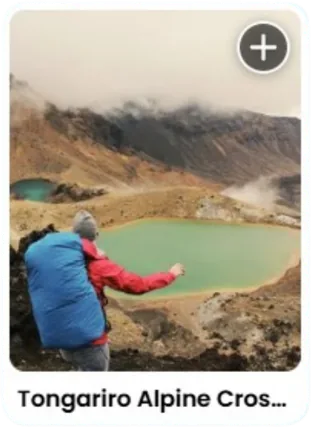
The Tongariro Alpine Crossing is the day they all call the highlight. About 30 mates, colleagues and family members joined them, with a dress code of fluoro (the more the better). After days of the three of them getting up and trekking off, it was different to wait for people to arrive, see mates they hadn't seen in a while and hear their kind words.
It wasn't an easy day, so props to everyone who came. The weather was perfect, not too hot and no rain. But they did it backwards, which is the harder way, and they don't recommend it.
I would have loved to be there for the Tongariro day, but I couldn't make it. It's been so cool following their journey the whole way through, from the planning to the trail.
After the crossing, Thomas went for a big ride towards National Park, pretty much passing the cars, until he ran out of gears. One of the boys says that ride would have been a highlight even without everyone else on the crossing. They liked the days that had both walking and riding in them.
Fishers Track and the Whanganui River by canoe
The next day, the weather turned. Will describes riding down Fishers Track on a gravel road in the rain, with two of the friends who'd join them on the river riding along in support. The road turned into a quad track that hadn't been ridden in years, so it was really muddy and fun to get down. It cleared up by the end.
That night was Whakahoro Bunkrooms, with a campsite full of people walking Te Araroa, so there were lots of faces around before their first day on the Whanganui River.
Two days on the Whanganui River
The first river day was 47 kilometres in Canadian canoes, two to a boat, with a mate along. Thomas says the goal was to do as little work as possible, so they took turns sitting at the front trying to fall asleep. The water moves along, so if you want to stop paddling, you can float on by, and there were lots of people on the river.
Thomas would really recommend it, with one condition:
"you have to do it with a load of friends. You have to do it in a massive group. That's the way to do it."
It's been on my bucket list for ages, and after hearing that, I'll persevere with wrangling enough people to go.
The night at a riverside campground was a rough one, thanks to the mozzies. The morning brought the third version of the Olly oats: oats with bacon and maple syrup. Thomas ranks it number two of the Olly oats.
Day 13 was a cruisy 21 kilometres. They tied up the boats and walked up to the Bridge to Nowhere, which was more interesting than Thomas expected, dropped some rocks off it and decided it was a really high bridge. That night was the Bridge to Nowhere campsite and a cabin, and the friends took the canoes out from there.
Matemateāonga Track to the top of Taranaki
Olly takes day 14. They walked the Matemateāonga Track, which leaves from the middle of nowhere, with no roads. You can only get there by canoe or jet boat, and since the trip was human powered, it was canoe.
The track was in great condition, and Olly says that was nearly the problem:
"the track was in great condition … it was almost … the bad part in a way because … you didn't really have to think at all"
He compares it to being on a motorway. You zone out, walk for hours and get the job done.
Stratford, Taranaki and the last lighthouse
Day 15 started with a 6 kilometre walk out to meet their support crew, then an 80 kilometre day on the bikes into Stratford, with a ride up the side of Taranaki in the afternoon. They stayed at the campground in Stratford.
On day 16 they drove back to East Egmont, where they'd finished riding, and climbed Taranaki. It was a highlight: snow at the top and the sea all around. Then they rode out from East Egmont and called it a day.
Day 17 was the ride to the cape, through farmland and rolling hills in a beautiful part of the country. They finished by carrying their bikes up the stairs of the lighthouse.
If you watch the video, they don't look super impressed. Mostly blank faces. It still felt like they'd wake up the next day and keep going. Walking up those steps was a big relief, and the whole trip felt like the blink of an eye: you start at East Cape, and now you're here.
Hard days, food and advice for starting big
Day two was the one that nearly broke one of the boys. He'd never ridden further than 80 kilometres before, and the first day was over 100. The others drafted him almost the whole way, and he calls it a team effort. Another describes reaching a point where the pain plateaus, and you sit there with it.
What got them through was breaking it down. They knew where they were sleeping every night, and after day three, with the longest walk and the longest ride done, they figured it couldn't get much worse. Thankfully, they were right.
Their packs were small: mostly a day pack, plus a sleeping bag on overnight sections. Olly kept stops to four minutes, which is not long to eat a snack bar. They got close to running out of food the whole time, and ate some of the food people had left in the huts (thanks to whoever left it, and they got to try some new noodle flavours).
Hearing about these distances, I'm shook. The longest day I've ever done was 28 kilometres, and it absolutely broke me. An 18 kilometre day is a big one for me.
Advice for starting something big
When I asked for advice for anyone wanting to do something big or small, Thomas shook his head. One of the boys pointed out that there's nothing stopping you from drawing a line, as they found with Olly.
Olly's advice is a little contrary:
"Well, I would say don't. And then if you still do after someone says that you shouldn't, … you obviously want to put the effort in. And if you want to put the effort in, then I'd say 100% just send it."
He says to follow your nose and make mistakes along the way. If someone had told him what to do, he wouldn't have learned as much. And don't be scared to reach out and ask questions. Being told not to does them good too: it fuels the fire.
Fundraising for Child Cancer Foundation
When Olly drew the line, one of the boys felt it would be selfish to keep something this good to themselves, so they decided to do it for a charity. They chose Child Cancer Foundation. None of them has a direct connection to child cancer. The more they talked to the foundation, the more they realised it was the charity for them, and it now has a special place in their hearts.
As they explain it, the foundation is all crowdfunded, with no government funding. It supports children going through cancer treatment or affected by cancer, and covers everything outside the treatment: school needs, swimming lessons, food, help with the mortgage, any kind of financial support. They see that side as overlooked, and say that when a child gets cancer, the whole family has to move with them.
How they fundraised
They set up a Givealittle page and pushed it out on social media, through community groups and work organisations, anywhere they could. By the start of the trip they were sitting at about $9,000, and when we recorded, the total was nearing the halfway mark of their goal.
Their biggest lesson: a lot of people want to see you finish. So leave the page open after you've done it. Donations kept coming in after they finished, and they planned to keep the page open for a while longer.
And what's next? Thomas had barely got home when Olly sent a screenshot of the South Island with two lines drawn across it and a question mark. It's a joke, apparently. For now, they'd like to recover.
Places from this episode
- East Cape
- Ōpōtiki
- Te Urewera
- Ruatāhuna
- Whirinaki River
- Kaingaroa Forest
- Kaimanawa
- Cascade Hut
- Tauranga-Taupō River
- Lake Taupō
- Waipakihi Hut
- Junction Top
- National Park
- Tongariro Alpine Crossing
- Fishers Track
- Whakahoro
- Whanganui River
- Bridge to Nowhere
- Matemateāonga Track
- Stratford
- East Egmont
- Taranaki
Follow Olly, Will and Thomas
The trip is on Instagram and Facebook as Cape to Cape 2024.
Links from this episode
- Donate to their Child Cancer Foundation fundraiser
- Follow Cape to Cape on Instagram: instagram.com/capetocape2024/
- Follow Olly on Instagram: instagram.com/olly.dow/
- Follow Will on Instagram: instagram.com/willdunn_mtb/
- Follow Thomas on Instagram: instagram.com/twinter.cc/
- Follow Abigail on Instagram: instagram.com/abigailhannnah
- Follow Aotearoa Adventures on Instagram: instagram.com/aotearoa_adventures_
More like this
- Bikepacking from Cape Reinga to Bluff with Greg and Lauren
- A Human Powered Adventure Along the 45th Parallel Traverse with Tanya
- Two NZ Epics - Bicycle Circumnavigation and Packraft Traverse with Dunc Wilson
- Bikepacking 3,000km in New Zealand on Tour Aotearoa with Laura Bell
Until then, keep adventuring :)
The ultimate
NZ road trip adventure guide
Packed with insider tips and stunning photography, this is the only resource you need to plan your journey.