Episode 172
Hiking the Tongariro Alpine Crossing and Tongariro Northern Circuit with Ben Boland

Episode 172
Hiking the Tongariro Alpine Crossing and Tongariro Northern Circuit with Ben Boland
Spotify Apple Podcasts Everywhere else Download
This episode started with a special voice note. Ben sent it to me while he was driving, after he'd listened to the entire Aotearoa Adventures catalogue and was, in his words, absolutely devastated to be caught up. It's one of the best voice notes I've ever received.
And Ben is the perfect person to talk Tongariro. He's a born-and-bred Kiwi who once couldn't think of anything worse than walking for three days. Then, in his early 30s, he got a dog, got far more active and started finding real joy in challenges he couldn't do before. His first big hike was the Tongariro Alpine Crossing. He's been back in summer and winter, and he's walked the Tongariro Northern Circuit twice.
So we go through both, section by section. The shuttles, the Devil's Staircase, Red Crater and the Emerald Lakes, the hut-to-hut days on the circuit, and the bits we both secretly hate. Plus his gear, his luxury food item and how to get started if you're where he once was. I've only ever done the circuit, and by the end of this chat I was pretty sure I need to go back and do the whole crossing. Go on, have a listen.
In this episode
- How Ben got into hiking
- His first Tongariro Alpine Crossing
- Tongariro Alpine Crossing, start to finish
- Tongariro Alpine Crossing safety and turning back
- Tongariro Northern Circuit, hut to hut
- Tama Lakes for sunrise
- Beating the crowds on the crossing
- Gear, hiking poles and Ben's luxury item
- Ben's advice for getting started
How Ben got into hiking
Ben describes a fairly typical Kiwi upbringing. The bush was there, but it wasn't an everyday thing, and outside of Scouts he didn't do much in the outdoors. When family came over from America to walk the Milford Track, he told them he could not think of anything worse than walking for three days. So they took him on a road trip instead.
That changed in his early 30s, when he got a dog and got far more active. Until about four years before we recorded, he was pushing 190 kilos. Getting out and seeing the country has become a big part of who he is, and these days he actively encourages people who don't think they can do it to get involved.
His first big hike came about when a very fit friend asked what would interest him. Ben wanted something more exposed and different to what he expected, so they picked the Tongariro Alpine Crossing. He signed up before he knew what he was in for. After that, he was doing one or two big hikes almost every week, including Taranaki and Ruapehu.
Then came the Great Walks. Ben didn't believe Milford Track bookings would sell out like a rock concert, so by the time he logged in at work, everything was gone. Then he found two spots in April, decided it was fate, booked them and called his partner to tell her they were doing the Milford. Surprise! The Paparoa Track is the one Great Walk he still has to go: DOC closed it the day before they were due to start, so it turned into a South Island road trip instead.
His first Tongariro Alpine Crossing
Ben calls his first crossing a humbling experience. He was still losing weight, and they didn't put a lot of planning into it. They happened to pick a bluebird day, and his friend made sure Ben had the right gear, enough water and snacks.
Ben took over directions to the start, and they ended up walking it backwards, against hundreds of people coming the other way. Cue all the weird looks. Near Blue Lake, one of the most volcanic sections with sharper rocks, they passed a kid walking it in bare feet, not even watching where he put them. Feet of steel.
They made it all the way to Red Crater, then turned around and walked back the way they came, because of the cars and the shuttle situation. Ben was blown away for the entire track.
Tongariro Alpine Crossing, start to finish
Here's the crossing as Ben describes it, in the usual direction.
Getting there: shuttles and bookings
The crossing is a one-way track and the car parks have strict time limits, so most people book a shuttle to the start. You can get one from around National Park village or Whakapapa Village, and it drops you at the trailhead near Mangatepopo.
When we recorded, you had to book to do the crossing, and you had to come in on a shuttle because you can't park your own car. The booking itself was free, and you pay for the shuttle. The DOC website covers everything (how long it is, what layers to wear, the shuttles), so check it for the current rules.
Soda Springs and the Devil's Staircase
From the trailhead you head up towards Soda Springs, which in the right weather has an awesome little waterfall. Then the climb starts: a steep staircase nicknamed the Devil's Staircase.
Before the stairs really kick in, there's a DOC sign telling you the easy part is over, and to take a moment to think about turning back. Ben found it easier after that point, partly because it gets really interesting. So on his second Northern Circuit, he told his partner at the sign that she was doing so well and it was easy from here. He hadn't read the sign. She was not impressed.
I'm with her. When I walked the circuit, the Devil's Staircase is the part that stuck in my head, because it was so so hard. It was summer, but up there it was cloudy and windy, and you could feel the weather change instantly. The top of the staircase is where you hit the alpine environment, so if bad weather is coming in, that's your turnaround point.
South Crater to Red Crater
At the top of the staircase you reach South Crater, which a lot of people call the plateau. It's flat, so it's a nice break, with views of Ngāuruhoe and up towards the Tongariro summit. Then comes the final climb to the top, and once you're up there, you very quickly see why it's called Red Crater.
The Emerald Lakes and the scree
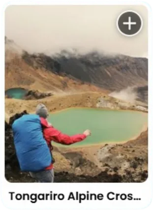
From Red Crater you look down on the Emerald Lakes, and across to the North Crater, the Central Crater and Blue Lake. The colour of the Emerald Lakes against the stark, barren landscape is the moment everyone has been hiking for, so this is where it gets congested: everyone stops for lunch.
Next comes what Ben thinks is one of the best parts of the crossing, the scree run-down. Once you get the hang of scree it's quite fun, but expect people bunching up as they find their footing. If you're on the Northern Circuit, this is where you turn right and head down a steep descent towards Oturere Hut.
Blue Lake and the walk out
On the crossing, you carry on with another climb, which feels like a kick in the teeth after everything you've done, up to Blue Lake (always far bigger than Ben remembers). You walk between Blue Lake and the North Crater, then zigzag down off the alpine section, past a few trees and out to the shuttles.
A lot of people talk down that long last stretch, but Ben rates it. If you like big, grand views, you keep the view of the lakes for most of it.
I'd always thought I didn't need to do the crossing because I'd done the circuit. But I would have missed Blue Lake, so maybe I do need to do the whole thing.
Ben's case for it:
"tourist spots are popular for a reason, right? … There is a reason that this walk is the busiest walk in the country. It's definitely underestimated on how hard it can be and how dangerous it can be, but it is probably going to be the one walk that I recommend to people if they're in the North Island saying, I've got one day, what am I doing for the best bang?"
Tongariro Alpine Crossing safety and turning back
The weather up there changes in a heartbeat. Ben says the crossing, the most popular day walk in the country, has more helicopter call-outs than any other track in New Zealand. People underestimate it, the weather changes, or they don't realise how hard 20-plus kilometres in a day can be with no shade. From the start until the last couple of kilometres there's no shelter of any sort, and not many places to fill up on water.
Ben's prep for the crossing:
- Layers. The weather can change out of nowhere.
- Sunscreen and cover. You're exposed all day, so slip, slop, slap and wrap.
- A raincoat, even on a bluebird day.
- Enough water for the whole crossing.
- Bright colours. On a hike, standing out might save your life.
The Mountain Safety Council has a video on the crossing, which is also on the DOC website. And if you're walking with a group, Ben's tip is to agree before you start that if anyone wants to turn back, everyone turns back. No questions asked, no prejudice, no grudges. If it's above your skill level, that's okay too: there are lots of smaller day walks in Tongariro National Park.
The crossing in winter
Ben's winter trip was just after the season, with snow still on the tops, and full disclosure, they weren't prepared. None of them had crampons and they didn't take a guide. It was overcast that morning, Ben had left the sunblock at the hotel, and they decided not to go back for it. It was the worst mistake he's ever made: the worst sunburn he's ever seen, with blisters on his face.
They had all slipped, and when it went from snow to ice under snow, they stopped at Red Crater and turned back. In winter you need extra alpine skills, and the weather is a lot more prone to changing.
That day they saw one other person. While they were melting snow for hot chocolate and coffee, a trail runner came up in the shortest shorts Ben has ever seen, asked what the ice was like, skipped across it like there was no obstacle and dropped to all fours to scale the last climb. Then he shouted back to put their fingers in the pole holes other people had left, and ran off into the distance. Ben has never felt so humbled.
"if people are uncomfortable or it's getting dangerous, there's nothing wrong with stopping and turning around. … you get a cool story of how it didn't work out. And so you went back and conquered it another time."
Tongariro Northern Circuit, hut to hut
The Northern Circuit is a three to four day Great Walk, and it shares the stretch from Mangatepopo to the Emerald Lakes with the crossing. When we recorded, it wasn't running as a Great Walk for the season: Oturere Hut was being rebuilt, and the Whakapapa to Mangatepopo section was closed after a fire. So check DOC before you plan it.
Ben has walked it twice: first with two friends, who tried to do it in two days because they didn't want to take annual leave, then over four days with his partner.
Whakapapa to Mangatepopo: the goat track
They started at 4am to walk the first section, nicknamed the goat track, by head torch. You get views of Ngāuruhoe and Ruapehu, but you're stepping down into what looks like a washed-out path from all the river run-off. They got sunrise on the way.
Ben's take: completionists will want to do it, but you can probably skip it, because you get the same views coming in from the road end at Mangatepopo.
I skipped it on my circuit, and I needed to save my energy for the Devil's Staircase anyway.
Mangatepopo to Oturere Hut
From Mangatepopo you follow the crossing route up through Red Crater to the Emerald Lakes. Where the crossing heads on towards Blue Lake, the circuit turns right, and the scenery changes again. It goes from volcanic to Mars: red rocks everywhere, a steep descent, then sand and rock that makes you feel like you're on the moon, all the way to Oturere Hut.
Oturere Hut to Waihohonu Hut
On the two-day attempt, they reached Oturere Hut, had a sleep, found the one spot on the deck with cell reception, called DOC and changed their booking to Waihohonu Hut, the next one on. Ben's not sure he'd do that again.
The next section feels more like a desert. Then you get your first cover in a forest, with a climb that looks like nothing on the elevation profile. They stopped so many times.
I remember struggling up through that forest too, so I feel justified.
Waihohonu Hut is one of the fanciest or nicest huts in the country, by Ben's count. It has two massive windows looking straight up the valley to Ngāuruhoe. A short walk away there's a freshwater spring where you can fill up your water, and if you're brave enough, have a quick swim.
Waihohonu Hut to Whakapapa Village
From Waihohonu, a short detour takes you to the old historic hut, worth a stop. Then the track is fairly flat and undulating, past a couple of streams, with Ruapehu on your left and Ngāuruhoe on your right. This part also makes up part of Round the Mountain.
My trick for telling them apart: Around the Mountain is Taranaki, because an A is shaped like Taranaki. Round the Mountain is Ruapehu, because they both start with R.
Then comes the side trip to the Lower and Upper Tama Lakes, which Ben cannot recommend enough. After that, the section from Tama Lakes to Taranaki Falls is the bit Ben hates with a passion, because it's always right before the end, when he's tired.
For me, it's Taranaki Falls to Whakapapa: you can see the Chateau and it's not getting any closer. Don't let either of us put you off.
Then you're back at Whakapapa Village, and there's your car. Boom, done.
Tama Lakes for sunrise
Tama Lakes is one of my hands-down favourite day hikes, and a really good alternative to the crossing if you don't have the fitness or don't want the crowds.
Every time I've done it, it's been for sunrise, so I start at a stupid o'clock in the morning and I'm home before lunch. My favourite was a winter morning with Isaac under a full moon. There was frost on everything, we didn't need our head torches, and the whole landscape sparkled. It might be one of my favourite mornings ever. Clear sky, full moon, winter sparkles: go for it.
In winter I'd say Tama Lakes is fairly safe, because you're not getting as much altitude, but it still depends on conditions and how much snow there's been. We always take little ice spikes just in case. A lot of the track is well graded, with boardwalk in places.
Beating the crowds on the crossing
A listener asked how Ben navigated all the people on the day-walk section, and whether it took away from the multi-day trip.
On his first crossing, they were walking against the flow, so they were never stuck behind anyone, and seeing so many people out there was really motivating. On his first circuit, the 4am start meant there weren't many people around, and the landscape is so vast that the people who are there disappear into the rocks.
On his second circuit, they had a campsite booked at Mangatepopo but arrived early and well rested. So they wrote in the intentions book that they were going to sleep on the volcano. Near Red Crater they veered off towards the Mount Tongariro summit and pitched the tent where they thought they were about 500 metres from the track (you have to be 500 metres off it). They had the place to themselves until some early risers ran up in the morning.
That's the thing about the busiest places: go at a different time of day, or in the shoulder seasons. Hooker Valley is always going to be chocka, but at sunrise or sunset you can basically have it to yourself.
Gear, hiking poles and Ben's luxury item
Ben is a self-confessed gear nerd: he buys something, decides it's really good, then buys more.
His first pack was an Osprey Atmos 65, and he still recommends it. It's a bit heavier, but when you put it on it feels like someone's hugging you, and it carries a lot of weight comfortably. He's since switched to a lighter Osprey.
Switching to my Osprey was probably the one thing that made my hiking more enjoyable. I used it on my first solo hike on the Old Ghost Road, and no blisters.
Ben hasn't nailed the no-blisters thing yet. He loses toenails on every big hike, so if you have tips, send him a message.
The rest of his kit:
- Hiking poles. He bought them before Mueller Hut, after noticing that people without poles said you didn't need them, and everyone with poles recommended them. They give you a second to take a break, and his set has the cork handles and carbon fibre of much pricier poles.
- A PLB. Because you should have one.
- Layers and a rain jacket, even on a day hike.
- A hiking layer and a hut layer. A fleece while he's walking, for breathability, and a puffer for the hut, which also helps with not stinking too much.
- Real food. After too many dehydrated meals, food is now his luxury item, and he's the one at every hut looking at what everyone else is cooking. A favourite: gnocchi with pesto and mozzarella. As soon as you eat it, the weight's gone.
I take my poles on multi-days but not day hikes, and they made all the difference on the long, flat last day of the Milford.
His other tip for cutting weight: the more water you drink, the less you have to carry.
Ben's advice for getting started
If you're where Ben once was, his advice is small steps. He reckons he's blessed with a bit of overconfidence, but he knows a lot of people are nervous and question their own capabilities.
"You don't have to push yourself far to make progress. You just have to take that little step. If you fail, that's fine. People aren't going to judge you for it. … Take the little steps and you'll find you go way further than you ever thought."
And if a trip doesn't work out, you get a cooler story: you tried, it didn't work, and you came back and nailed it.
Ben says the podcast got him through the winter blues and motivated him into an amazing summer.
Messages like his are what keep me recording, because sometimes it feels like I'm speaking into the void. Thank you, Ben.
Places from this episode
- Tongariro National Park
- Tongariro Alpine Crossing
- Tongariro Northern Circuit
- Mangatepopo
- Soda Springs
- Devil's Staircase
- South Crater
- Red Crater
- Emerald Lakes
- North Crater and Central Crater
- Blue Lake
- Oturere Hut
- Waihohonu Hut
- Tama Lakes
- Taranaki Falls
- Whakapapa Village
- Round the Mountain
- Milford Track
- Paparoa Track
- Mueller Hut
- Old Ghost Road
Follow Ben
- Instagram: @ben.outthere
More like this
- Starting Tramping in her 40s and Lake Waikaremoana as a Family with Lois Baldwin
- Solo Hiking the Routeburn Track with Emily
- Tramping the Heaphy Track from Karamea to Collingwood with Jacq Nesbit
- Turning New Zealand Work Trips into Solo Great Walk Adventures with Nick Thompson
Until then, keep adventuring :)
The ultimate
NZ road trip adventure guide
Packed with insider tips and stunning photography, this is the only resource you need to plan your journey.